
 desk
desk Share
Share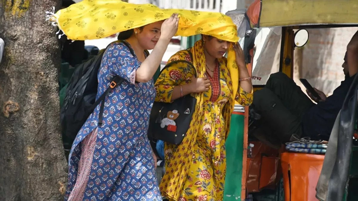
Heat wave continues in the plains of North India. Temperatures are crossing 40 degrees Celsius in Delhi, Punjab, Haryana, Rajasthan, Uttar Pradesh. The weather department has predicted that the weather will change on Thursday and Friday due to the activation of western disturbance.
It will remain cloudy at some places including Delhi
Some places including Delhi will remain cloudy, there may be light rain along with strong winds. 8th April was the hottest day in Delhi in the last three years. The maximum temperature was recorded at 41 degrees Celsius, 5.9 degrees above normal.
In Punjab, the maximum temperature in Bathinda and Faridkot reached 43.1 degrees Celsius. Similarly, the temperature in Barmer and Jaisalmer of Rajasthan was recorded at 46 degrees Celsius.
Heat wave hit Delhi for the second consecutive day on Tuesday
According to the India Meteorological Department, maximum temperatures equal to or above 43 degrees Celsius were recorded at 27 centres located in Gujarat, Rajasthan, Maharashtra and Madhya Pradesh. Heatwaves also blew at 19 of these places. Heatwaves blew for the second consecutive day in the capital Delhi on Tuesday. Due to this, hot winds were felt.
The weather department has issued a yellow alert for Wednesday and forecast a heat wave. The maximum temperature is expected to be 40 degrees Celsius and the minimum temperature is expected to be 23 degrees Celsius. In Rajasthan, life has been affected due to June-like heat in the month of April itself.
Heat wave warning issued in many districts of Rajasthan
The weather department has issued a warning about heat wave in many districts of Rajasthan. According to the weather department, heat wave may occur in many districts of Punjab on Wednesday afternoon. There is a possibility of light rain at some places in the afternoon and dust storm at a speed of 30 to 40 kilometers per hour.
Cloudy weather prevails in hilly states, light rain occurs
On Tuesday, the sun shone brightly in the morning in Dehradun and its surrounding areas. Wind started blowing in the afternoon and partial clouds also started hovering. Dense clouds remained in the mountainous regions. However, there was light drizzle at some places. At the same time, the maximum temperature in the plains of the state was more than 35 degrees Celsius.
It rained on the mountains
According to the Director of the Meteorological Center, Bikram Singh, light rain may occur in Uttarkashi, Chamoli, Rudraprayag, Bageshwar, Pithoragarh, Champawat and surrounding areas on Wednesday.
On the other hand, the effect of western disturbance was seen in Jammu and Kashmir on Tuesday. It rained in the mountains and most of the lower areas including Srinagar remained cloudy. The sky remained clear in Jammu.
According to the Meteorological Department, most parts of the state including Jammu and Srinagar may receive rainfall on Wednesday and Thursday. There is also a possibility of snowfall in some high mountain areas in the next three days.
Light snowfall in Kunjum and Rohtang
People in Himachal Pradesh got some relief from the heat that was prevailing for the last two days due to snowfall on the peaks. On Tuesday, light snowfall occurred on the high peaks of the state Baralacha, Kunjum and Rohtang and light rain occurred in Manali. Winds blew after clouds covered many places including Shimla. On the other hand, hot winds blew in Dharamshala, Bhuntar and Sundarnagar.
--Advertisement--