







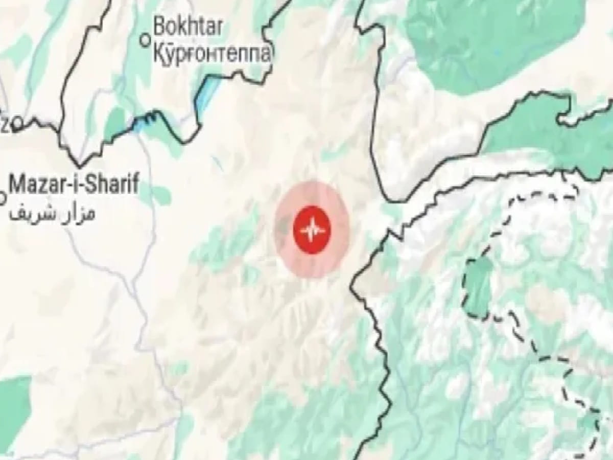
4.0-Magnitude Earthquake Strikes Pakistan Near Afghanistan Border
Mild yet sudden seismic tremors jolted border communities across northwestern Pakistan and eastern Afghanistan on Sunday morning, November 22, 2026, after a 4.0-magnitude earthquake struck close to the Pakistan–Afghanistan border, prompting anxious residents to rush out of their homes into open streets and courtyards. According to official seismological data released by India's National Center for Seismology (NCS)—and logged under the "reviewed" seismic bulletin—the tremor occurred at 9:18 AM Indian Standard Time (IST) (corresponding to 8:48 AM Pakistan Standard Time), originating at a relatively shallow focal depth of 13 kilometres beneath the rugged mountain terrain straddling the frontier. Pinpointed at latitude 32.794° North and longitude 69.745° East—a mountainous belt located near Pakistan's North Waziristan / Khyber Pakhtunkhwa border corridor adjacent to Afghanistan's Paktika and Khost provinces—the shallow depth amplified surface shaking in nearby settlements even though the overall magnitude remained moderate. Geographical distance bearings issued by the NCS placed the epicenter roughly 202 kilometres south-southeast of Afghanistan's capital Kabul, 322 kilometres west-southwest of Pakistan's capital Islamabad, 430 kilometres west of Rajouri in Jammu and Kashmir, and 452 kilometres west-southwest of Gulmarg. Meanwhile, parallel seismic monitoring by the Pakistan Meteorological Department's National Seismic Monitoring Centre (NSMC) in Islamabad also recorded morning seismic activity along the western frontier belt—including a 4.7-magnitude tremor at 8:48 AM PST at a depth of 15 km located 82 km southwest of Zhob in Balochistan (31.04°N, 68.62°E)—underscoring heightened tectonic restlessness across the Sulaiman and Hindu Kush collision zones. Fortunately, no immediate reports of structural collapse, loss of life, or major injuries emerged from the border districts following Sunday's 4.0-magnitude quake, though local authorities urged citizens to remain cautious against potential aftershocks. For residents, disaster-management planners, geologists, and readers across Islamabad, Kabul, Peshawar, Srinagar, Jammu, Rajouri, New Delhi, Unnao, and Lucknow, Sunday's tremor serves as a timely reminder of the active seismic fault lines running across South Asia.
Pakistan–Afghanistan Border Earthquake (Nov 22, 2026): NCS Coordinates, Depth & Distance Map
To bring together the verified seismic parameters published by the National Center for Seismology (NCS) for Sunday morning's 4.0-magnitude earthquake, the directional distances from major regional capitals and towns in India, Pakistan, and Afghanistan, and recent regional seismic context, the tables below summarize the core facts:
Verified Seismic Parameters of the November 22, 2026 Earthquake (NCS Data)
| Seismic Parameter | Verified Official Reading | Scientific & Civic Significance |
| Magnitude & Event Status | 4.0 Magnitude (classified as "reviewed" in the National Center for Seismology bulletin). | Moderate earthquake capable of producing noticeable indoor shaking near the epicenter without widespread structural destruction. |
| Date & Origin Time | Sunday, November 22, 2026 at 09:18 AM IST (08:48 AM PST / 08:18 AM AFT). | Struck during morning household hours, prompting residents in nearby border settlements to evacuate outdoors quickly. |
| Epicenter Coordinates | Latitude 32.794° N, Longitude 69.745° E (Pakistan–Afghanistan border region). | Lies in the tectonically active mountain belt between Khyber Pakhtunkhwa (Pakistan) and eastern Afghanistan. |
| Focal Depth | 13 kilometres (shallow crustal earthquake). | Shallow earthquakes (less than 70 km deep) transmit seismic waves rapidly to the surface, making shaking feel sharper locally. |
| Casualties & Damage Status | No immediate reports of casualties or major property damage reported after the tremor. | Local residents stepped out of homes briefly as a precaution before resuming normal morning routines. |
Distance & Bearing of the Epicenter From Major Regional Cities
| City / Town & Country | Approximate Distance From Epicenter | Direction From Epicenter |
| Kabul, Afghanistan | 202 km | South-Southeast of Kabul |
| Islamabad, Pakistan | 322 km | West-Southwest of Islamabad |
| Rajouri, Jammu & Kashmir (India) | 430 km | West of Rajouri |
| Gulmarg, Jammu & Kashmir (India) | 452 km | West-Southwest of Gulmarg |
Why Shallow 13-Km Earthquakes Feel Sharper Near the Pakistan–Afghanistan Border
Seismologists note that the Pakistan–Afghanistan border and the adjoining Hindu Kush–Sulaiman mountain arc sit directly along the active boundary where the Indian tectonic plate drives northward beneath the Eurasian plate. Because Sunday's 4.0-magnitude quake originated just 13 kilometres below the surface—far shallower than deep-focus Hindu Kush tremors that often strike at depths of 150 to 200 kilometres—seismic energy reached nearby villages with minimal attenuation, explaining why people stepped swiftly out of their homes even though cities several hundred kilometres away in Jammu and Kashmir did not feel strong shaking.
Back-to-Back Regional Tremors Prompt Vigilance Across South Asia
Sunday's 4.0-magnitude tremor follows closely on the heels of a 4.6-magnitude earthquake that struck Afghanistan at a depth of 159 kilometres on Saturday afternoon, November 21, 2026 (at 3:40 PM IST), as well as morning seismic activity recorded near Zhob in Balochistan. Disaster-preparedness officials across Pakistan, Afghanistan, and northern India emphasize keeping emergency kits accessible, moving to open spaces away from weak masonry walls during tremors, and relying strictly on verified bulletins from agencies like the National Center for Seismology (NCS) rather than unverified social media rumors.